
Why the Great Plains Keep Getting Skipped
Most travelers fly over the Northern Great Plains on their way to somewhere else. That instinct, understandable as it is, leaves behind one of the most genuinely uncrowded travel experiences available in the United States. No reservation queues, no timed-entry permits, no $40 parking lots - just horizon-to-horizon space that costs almost nothing to access.
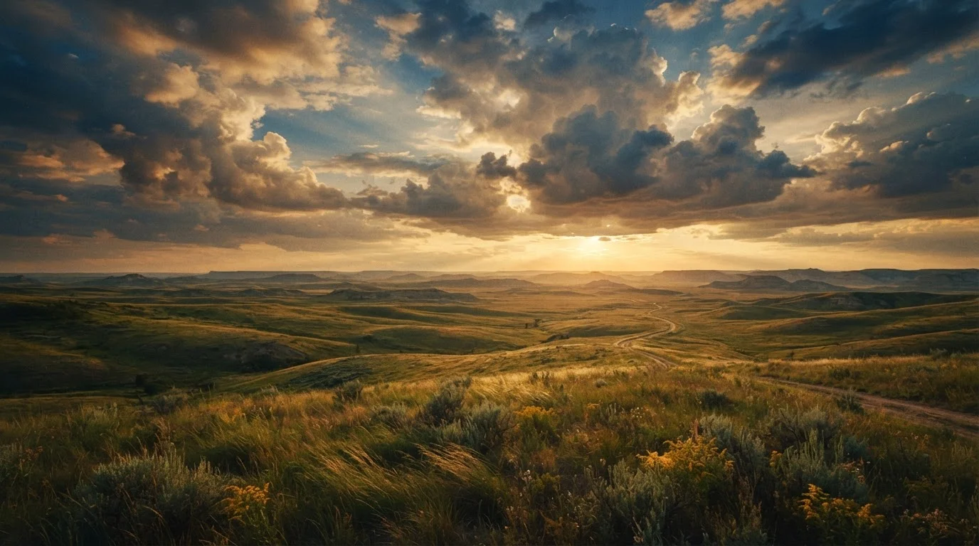
The region's reputation as flat and featureless doesn't survive a single road trip through it. The terrain shifts constantly: eroded badland spires, grass-covered dunes, spring-flooded wetlands, and cottonwood-lined river valleys all appear within a few hours of each other. Flyover country stereotypes don't hold up once you're actually on the ground.
~20,000
Square miles of Nebraska Sandhills
The Nebraska Sandhills is the largest grass-stabilized sand dune system in the Western Hemisphere, according to the University of Nebraska.
400,000-600,000
Sandhill Cranes on the Platte River
The Crane Trust and Audubon Society estimate this many cranes stage along Nebraska's Platte River during the spring migration window.
Top 5
Least-visited US states
North Dakota and South Dakota consistently rank among the least-visited states by domestic travelers, per annual National Travel & Tourism Office data.
The Badlands' Quieter Edges: Beyond the Main Entrance
Badlands National Park draws visitors almost exclusively through its North Unit - the stretch visible from Interstate 90. But the park's South Unit, accessible through the Pine Ridge Reservation via Sheep Mountain Table Road, sees a fraction of the traffic and delivers equally dramatic eroded formations. Because this unit sits within tribal land, visitors should confirm current access conditions and any applicable entry considerations directly with the National Park Service and Oglala Sioux Tribe before visiting.
Just outside the park's boundaries, Buffalo Gap National Grassland surrounds the park on multiple sides. This is public BLM-administered land where dispersed camping is generally permitted at no fee - though rules change, so always verify current regulations with the local field office. National monuments, state forests, and BLM land often rival famous parks in scenery - and Buffalo Gap is a strong case in point.
When visiting the Badlands' less-trafficked areas, go at first light or the last hour before sunset - the angled light transforms the formations and wildlife activity peaks at dawn and dusk.
Low-angle light dramatically improves both the visual experience and photography in eroded badland terrain; large mammals like bison and pronghorn are most active at these times.
In the Sandhills, follow the gravel section roads rather than staying on paved highways - the network of county roads opens up lake access, birding pullouts, and ranch vistas that most visitors never see.
The Sandhills' most scenic terrain is largely roadside-accessible via public gravel roads, making it possible to explore the landscape without any technical hiking.
Nebraska's Sandhills: The Most Underrated Landscape in America
Covering roughly 20,000 square miles of north-central Nebraska, the Sandhills is the largest sand dune formation in the Western Hemisphere - entirely grass-stabilized, rolling green in summer, and home to one of the densest concentrations of freshwater lakes in the country. It's also almost completely unknown outside the region.
The Niobrara National Scenic River runs along the Sandhills' northern edge and offers one of the genuinely affordable float trip experiences in the US - canoe and tube outfitters in Valentine, NE, operate at rates well below what comparable river experiences cost elsewhere. The town of Valentine itself - population under 3,000 - functions as a low-key base with motels priced far below national averages.
For wildlife, the Sandhills punch well above their weight. The Platte River corridor, just south, hosts one of the great wildlife spectacles in North America: the annual migration of roughly 400,000 to 600,000 Sandhill Cranes between February and April. Many state parks charge little to nothing at the gate yet deliver scenery and wildlife on par with national icons - Nebraska's Fort Kearny State Recreation Area is a prime crane-viewing spot with a modest entry fee.
Time the Crane Migration Right
Sandhill Crane peak staging along Nebraska's Platte River typically falls between mid-February and late March, with exact timing varying by year and weather. Arrive before sunrise at a viewing blind or river access point for the most dramatic takeoff scenes. The Crane Trust and Audubon's Rowe Sanctuary both offer guided dawn viewings - check their sites directly for current availability and any associated fees.
North Dakota's Prairie Potholes and Hidden State Parks
North Dakota is statistically among the least-visited states in the country - a fact that works entirely in the budget traveler's favor. Theodore Roosevelt National Park's South Unit gets moderate traffic; its North Unit, 70 miles away, is dramatically quieter and widely regarded by rangers as the more scenic of the two.
Beyond the national park, the state's network of state parks - including Lake Metigoshe, Turtle River, and Cross Ranch - charge modest daily vehicle fees and offer camping at rates significantly below national park campgrounds. Cross Ranch State Park protects one of the last free-flowing stretches of the Missouri River and a remnant bison herd.
The Prairie Pothole Region - a vast network of seasonal wetlands created by glacial activity - makes North Dakota one of the premier waterfowl migration corridors in North America. Birders travel internationally to visit this region; most US travelers have never heard of it.
Prairie Weather Changes Fast
Severe thunderstorms, high winds, and flash flooding can develop rapidly on the open Plains, particularly in spring and early summer. Before driving remote stretches, check the National Weather Service forecast and be aware that low-water crossings can flood quickly after heavy rain. If you see a tornado or rotation in the sky, do not try to outrun it in your vehicle - seek substantial shelter immediately.
Practical Planning: Getting There, Staying Cheap, Staying Safe
Getting there: The Northern Great Plains is road trip territory by necessity and by design. Driving is the only practical way to connect the dispersed highlights. Fly into Rapid City, SD; Bismarck, ND; or Denver, CO as a starting point depending on your route, then rent a car or drive your own. Fuel costs are a real consideration on long stretches - plan fill-ups in larger towns rather than relying on isolated rural stations.
Accommodation: Independent motels in small Plains towns - Valentine NE, Mobridge SD, Williston ND - typically run well below chain hotel rates in comparable locations elsewhere in the US. Camping, where available and permitted, is the most economical option and keeps you closest to the landscape. Always carry sufficient water; services are sparse.
Food: Grocery shopping in larger regional towns before heading into rural areas keeps costs low and ensures you're not dependent on the limited options in very small communities.
For a contrasting perspective on what quiet, affordable landscapes look like in a different region, see our piece on quieter Desert Southwest landscapes that cost less to explore.
What to Know Before You Go
Seasonality: May-June and September are the practical sweet spots - temperatures are manageable, wildflowers or fall color add visual drama, and accommodation rates are at their most favorable. Midsummer on the open Plains can reach extreme heat; winter brings genuine isolation and road hazards. Always check weather forecasts and road conditions before setting out.
Safety basics: Cell service is genuinely limited across large portions of this region. Download offline maps before you leave, carry a paper backup, and let someone know your itinerary. Carry more water than you think you need. If hiking off-trail in badland terrain, wear ankle-supportive footwear - the eroded clay is unstable.
Wildlife awareness: Bison on open roads and trails are common in and around Theodore Roosevelt National Park and other protected areas. They are large, fast, and unpredictable. Maintain a minimum distance of at least 25 yards - more if the animal shows any signs of agitation. Never approach bison for photographs.
Visa, entry, and border crossing information for international visitors should always be confirmed through official US government sources before travel. Conditions, fees, and access policies at specific public lands can change - verify with the managing agency (National Park Service, US Forest Service, or state parks department) directly before your visit.
Some of America's richest arts and food scenes thrive in cities most travelers skip - pairing a Plains road trip with a stop in Sioux Falls or Bismarck adds an urban anchor to an otherwise deeply rural itinerary.
This article is for general informational purposes only. Access, fees, road conditions, and regulations for public lands change regularly - always verify current conditions with the relevant managing agency before your visit. Travel safely and follow all posted guidelines at natural areas.